【新唐人2014年04月03日讯】在德国总理赠送中国历史地图的同时,菲律宾渔船日前突破中国海警船的封锁,在有争议的岛礁,为废弃军舰提供人员换防和物资补给,菲律宾还向海牙国际法庭递交诉状,指控中国在南中国海划设的国界线违反海洋法公约。中国历史上11段线的国界线,何时变成了9段?是谁出卖了中国的土地?我们一起看看。
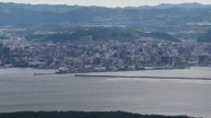
菲律宾3月28号突破中国海警船的封锁,到有主权争议的仁爱礁,为废弃军舰提供人员换防和物资补给,并在29号正式向海牙国际仲裁法庭,提交了长达4000页的诉状,指控北京在南中国海的“九段线”划界,违反海洋法公约。
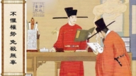
据历史资料记载,第二次世界大战结束后,“中华民国”作为战胜国,国民政府根据《开罗宣言》和《波茨坦公告》组织军队,对日本曾经侵占的南海诸岛进行接收,经过实地勘察、测量后,1947年完成了对南海诸岛的命名工作。1948年对外公布标有11段“断续国界线”的《南海诸岛位置图》,在以后几十年的国际社会间没有人提出异议。
1953年中共为了拉拢越南共产小兄弟,对原有的11段的“断续国界线”进行调整,将北部湾两段去掉,造成11段线变成“九段线”。
1982年,联合国设立《联合国海洋法公约》,规定离陆地12海里处为本国领土,对东海诸岛和南海诸岛的争议划出了明确界限,而这些界限和“中华民国”划定的海洋界限严重冲突,中共参加了海洋法会议,并在《海洋法》上签字承认。
美国中文杂志《中国事务》总编辑伍凡:“那么现在要按哪一条呢,11条线中华民国是根据历史上的资料,再加上日本投降后这些岛都要归还出来,中华民国去接收了,中华民国移到台湾以后,中共也接收了,中共相当时期不管南海,给菲律宾、越南占领了,所以矛盾就出来了,如果你要根据《海洋法》,你要放弃9条。”
对于菲律宾的上诉,中共外交部发言人洪磊说,中方已多次表明不接受菲方就中、菲南海争端,提起的国际仲裁。对于岛礁主权争议和海域划界问题,中方坚持与有关当事国直接谈判解决争议。
旅美时政评论专栏作家胡平:“他嘴上必须坚持不放弃,但是实际上他知道这个恐怕站不住脚,而且自己的力量也有一定的限度,所以在处理具体问题的时候,还是有一定的灵活性和妥协,但嘴上还是要那么坚持。”
伍凡:“共产党,如果它把它放弃的话,那它就是个卖国贼,因为你当政你要守着家产,你不守家产,你就是败家子,我反共比谁都坚决,我是个民族主义者,我要保护中国的财产。”
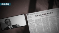
在最近几天,中共国家主席习近平访问德国期间,德国总理梅克尔送上了一张绘于1735年的中国地图,这张地图是当年德国的传教士和法国的传教士画出来的,其中中国的版图也包括南海。
这张地图传出后,让接受中共教育出来的民众大吃一惊。民众把这张地图和“中华民国”地图,以及现在的中国地图做对比,看看中共夺权后使中国失去了多少土地。
旅澳历史专家李元华:“包括外蒙古,包括跟苏联交界的,还有南亚一些地区那都是中共去出卖的,这个出卖实际上49年后就在做,最辱国的就是89六四之后江泽民上台,把相当于几十个台湾岛这么大的领土给了俄国。”
1979年邓小平为夺取军权,发动所谓的“对越自卫反击战”,据民间公布的数字,当时牺牲了十几万中国军人,而20年后的1999年,当年激战的边境地区云南老山和广西法卡山,由前中共总书记江泽民签字划归越南,从此中国阵亡将士尸骨永远埋葬在异国他乡。
采访编辑/刘惠 后制/陈建铭
Philippines vs. China – Sparks Fly Over Disputed Water
When Xi Jinping received an historical map from the German
Chancellor,
a Philippine government vessel maneuvered around the
disputed reef in the South China Sea delivering
provisions to Philippine troops stationed in the area.
The Philippines filed a case against China on Sunday at an
arbitration tribunal in The Hague,
indicating that Beijing violated the U.N. Convention on the
Law of the Sea (UNCLOS).
The nine-dotted line, covering the sovereignty claimed by the
CCP in the South China Sea used to be eleven-dotted-lines.
Who altered it? Who betrayed the territory of the
Chinese people?
Let´s take a look.
On March 28, the Philippine vessel evaded two Chinese
coastguard ships trying to block its path to deliver food, water
and fresh troops to a military outpost on the shoal, Ren’ai reef.
On March 29, the Manila government also submitted to the
tribunal evidence of 4,000 pages
accusing Beijing of breaching the UNCLOS with its
nine-dotted line territory claim in the South China Sea.
According to historical records, after World War II,
the Republic of China as the victor country,
the then Nationalist Government retrieved the South China
Sea islands from Japan and conducted field investigations
and measurements.
In 1947, naming of the islands was completed.
In 1948, a map of the South China Sea and Islands labeled
with eleven-dotted lines as the demarcation line was published.
No objection was raised even decades after the map was
published.
In order to win over the Communist Vietnam, the CCP deleted
two dotted lines in the northern gulf in 1953.
The eleven-dotted lines became nine-dotted lines.
In 1982, the United Nations Convention on the Law of the Sea
regulated that every State has the right to establish the breadth
of its territorial sea up to a limit not exceeding 12 nautical miles.
It was a clear boundary violation of the sovereignty of the East
China Sea and the South China Sea and the Islands of the Republic
of China.
However The CCP participated in the Convention,
and signed and recognized the agreement.
Chris Wu, China Affairs magazine Editor-in-Chief:
“Which one to follow? The eleven dotted lines was an historical
presentation of the territory, included the islands occupied by
Japan during WWII.
After Japan was defeated, they were returned to the
Republic of China, and later to the Communist regime.
But, for a long time the CCP cared nothing for those
islands which were then occupied by the Philippines and
Vietnam. But,now the conflict arises.
If you want to follow the UNCLOS, you´ll have to give
up on the nine-dotted line."
Chinese Foreign Ministry spokesman Hong Lei responded that
China would not accept arbitration,
and that China was committed to managing and resolving
relevant issues through dialogue.
Hu Ping, US-based columnist and commentator: “The CCP
will insist on not giving up,
but know well that it is probably untenable, because their
force is limited.
There´ll be some flexibility and compromises, but still being
insistent on the talks."
Chris Wu: “If the Communist Party abandons it, then they are
the traitors.
They become the black sheep for giving up on their own territory.
I am strongly anti-communist. I am a nationalist and I want
to protect China’s assets."
On March 28, the German Chancellor, Angela Merkel,
presented the visiting Chinese President, Xi Jinping, with a map
of China from 1735 drawn by the German missionaries and
French missionaries.
The map showed China’s 13.5 million square kilometers of
territory, including the South China Sea.
The publicized map was a surprise to the people in China after
decades of rule by the CCP.
People were shocked to discover the vast loss of Chinese
territory following the rule of the CCP
by comparing the 1735 map with that of the Republic of China
map, and the current one under the CCP rule.
Li Yuanhua, historian: “The CCP has betrayed China by
giving up on Mongolia, the junction with the Soviet Union,
and areas of South Asia.
This betrayal has started since 1949.
1989 was the most blatant when Jiang Zemin came to power.
He gave up territory equivalent of dozens of Taiwans to Russia."
In 1979 Deng Xiaoping launched the Sino-Vietnamese War to
seize military power.
Civil figures revealed hundreds of thousands of Chinese
soldiers were killed in this border war.
However, 20 years later, the border areas of battle such as
Laosan of Yunnan Province and Faka Hill of Guangxi Province
were given to Vietnam by Jiang Zemin in 1999.
Since then, those who died for the border war were forever
buried in a foreign territory.
Interview/Liu Hui Post-Production/Chen Jianming